 |
Mid East Maps |
|
Mid East Maps |
Text of UN General Assembly Resolution 181
Map of Jerusalem 'Corpus Separatum' according to UN Resolution 181
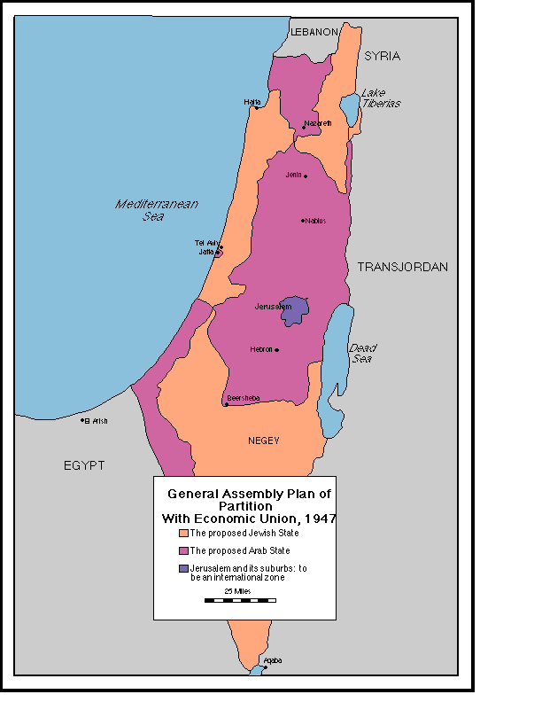
Detail Map of Partition
The United Nations Special Commission on Palestine (UNSCOP) recommended that Palestine be divided into an Arab state and a Jewish state. The commission called for Jerusalem to be put under international administration The UN General Assembly adopted this plan on Nov. 29, 1947 as UN Resolution (GA 181). The plan for "partition with economic union" divided the land into several cantons. Both the Jewish state and the Arab state had 3 cantons each that touched each other south of Nazareth and near Gaza. The borders of this plan are shown in the map below. This jigsaw puzzle would have been difficult to implement for friendly populations, and was impossible to implement given the hostility between Arabs and Jews. Click here for more history.
 |